Inicio > Ciencias de la tierra, geografía, medioambiente, planificación > Geografía > Factors in the increase of floods from Niger to Benin
Factors in the increase of floods from Niger to Benin

Factors in the increase of floods from Niger to Benin

Abraham A. Ayéna / Idelbert D. Behanzin / Tchékpo Théodore Adjakpa

68,80 €
IVA incluido
Consulta disponibilidad
Editorial:
KS OmniScriptum Publishing
Año de edición:
2023
Materia
Geografía
ISBN:
9786205791950
Añadir a favoritos

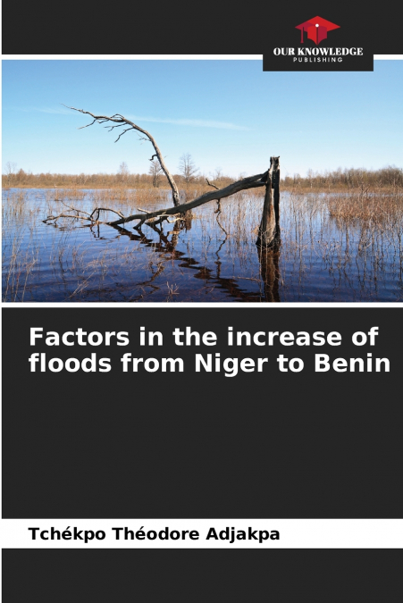
During the decade 2006-2016, floods recorded in West Africa have increased in a context of decreasing rainfall. The present study aims to analyze the factors of the increase in floods in the Niger River basin in Benin, more precisely in the Communes of Malanville and Karimama. It was carried out using the Accelerated Participatory Research Method (APRM). The qualitative and quantitative data collected over the period 1954-2013 were processed using Excel and Arc-GIS 10.3 software. The results obtained indicate that several natural and anthropogenic factors aggravate flooding in the Niger River basin in Benin. They are related to the proximity of the two Communes to the main course of the river, silting, degradation of the vegetation cover, anarchic occupation of the river banks and intensification of agricultural activities in the flood plains.

Artículos relacionados

  • Tourism and Indigeneity in the Arctic
    This is the first book to exclusively address tourism and indigenous peoples in the circumpolar North. It examines how tourism in indigenous communities is influenced by academic and political discourses and how communities are influenced by tourism. The volume seeks to challenge stereotypical understandings of indigenousness and indigeneity. ...
    Disponible

    193,92 €

  • Playas en la costa caribeña colombiana
    Diva Marcela Piamba Tulcán / Eduardo Silva Peña / Eliana Díaz Muñoz / Juliana Javierre / Mónica María Del Valle Idárraga / Yessica Chiquillo
    En este libro, reconstruimos el surgimiento y transformación de varias playas del hoy llamado Caribe colombiano, como playas turísticas, entre 1950 y 1990. Mediante un análisis de archivos periodísticos y audiovisuales y de narraciones de Amira de la Rosa, Jaime Manrique, Fanny Buitrago, Tomás González, entre otros, desanudamos el cronotopo playas, tomando como foco Prado Mar y...
    Disponible

    20,75 €

  • Coastal erosion dynamics of Dakar, Senegal
    Ibrahima Pouye
    The advancing sea resulting from sea level rise, combined with the effects of climate change and hydrodynamic agents, is affecting the coastal morphology of the Dakar region. As a result, a reduction of coastal areas is observed in some coastal zones, causing human displacement inland and disrupting economic activities such as fishing and tourism. Coastal erosion makes the coas...
  • Morfometria da bacia do Karasu
    ALİ İMAMOĞLU / Merve Yılmaz
    A área de investigação situa-se na secção central de Kızılırmak da região da Anatólia Central. As linhas de secção de água do ribeiro Karasu limitam a área de investigação. A ribeira de Karasu, que constitui a área de investigação, forma a sub-bacia do rio Delice, um dos importantes braços do Kızılırmak. O ribeiro Karasu, que se estende aproximadamente na direção este-oeste, de...
  • Geographie Information und Technologie
    Hossein Gholami / Maryam Marani-Barzani / Shahide Dehghan
    In den letzten Jahrzehnten hat die geografische Informationstechnologie weite Verbreitung und Anwendung in vielen Arten von Organisationen gefunden und in verschiedenen Bereichen der Gesellschaft große Aufmerksamkeit erlangt. Es werden die wichtigsten Triebkräfte und Anwendungen der geografischen Informationstechnologie in Organisationen ermittelt und ein Überblick über die Anw...
  • Géographie, information et technologie
    Hossein Gholami / Maryam Marani-Barzani / Shahide Dehghan
    Au cours des dernières décennies, les technologies de l’information géographique se sont répandues et sont devenues applicables dans de nombreux types d’organisations et ont suscité une grande attention dans différents secteurs de la société. Identifier les principaux moteurs et applications de la technologie de l’information géographique dans les organisations et fournir une v...

Otros libros del autor

  • Fattori dell’aumento delle inondazioni dal Niger al Benin
    Abraham A. Ayéna / Idelbert D. Behanzin / Tchékpo Théodore Adjakpa
    Nel decennio 2006-2016, le inondazioni registrate in Africa occidentale sono aumentate in un contesto di diminuzione delle precipitazioni. Il presente studio si propone di analizzare i fattori dell’aumento delle inondazioni nel bacino del fiume Niger in Benin, più precisamente nei Comuni di Malanville e Karimama. È stato condotto utilizzando il metodo della ricerca partecipativ...
  • Factores no aumento das cheias do Níger para o Benin
    Abraham A. Ayéna / Idelbert D. Behanzin / Tchékpo Théodore Adjakpa
    Durante a década 2006-2016, as cheias registadas na África Ocidental aumentaram num contexto de diminuição da pluviosidade. O presente estudo visa analisar os factores do aumento das inundações na bacia do rio Níger no Benim, mais precisamente nas comunas de Malanville e Karimama. Foi realizado utilizando o Método Acelerado de Investigação Participativa (APRM). Os dados qualita...
  • Faktoren für das erneute Auftreten von Überschwemmungen vom Niger nach Benin
    Abraham A. Ayéna / Idelbert D. Behanzin / Tchékpo Théodore Adjakpa
    In den zehn Jahren von 2006 bis 2016 haben die Überschwemmungen in Westafrika vor dem Hintergrund sinkender Niederschlagsmengen zugenommen. Ziel der vorliegenden Studie ist es, die Faktoren für die Zunahme von Hochwasser und Überschwemmungen im Becken des Flusses Niger in Benin, insbesondere in den Gemeinden Malanville und Karimama, zu analysieren. Die Studie wurde mithilfe der...