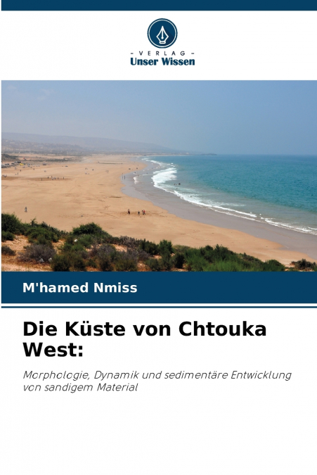
Die Küste von Chtouka West

Die Küste von Chtouka West

M’hamed Nmiss

88,39 €
IVA incluido
Consulta disponibilidad
Editorial:
KS OmniScriptum Publishing
Año de edición:
2023
Materia
Geografía
ISBN:
9786206100652
Añadir a favoritos

Mit ihrer südlichen Breitenlage von 30N° ist die Küstenregion der West-Chtouka eine extrem empfindliche aride bis semiaride Umgebung. Auf einem 33 km langen Küstenstreifen zwischen der Mündung des Oued Souss und der Mündung des Oued Massa weist die Küstenlandschaft der Chtouki eine beachtliche morphologische Vielfalt mit unterschiedlichen geomorphologischen Formen und Formationen auf. Die Küste der westlichen Chtouka ist von einer umfangreichen Sandbedeckung geprägt. Die Entwicklung dieser sandigen Ansammlungen ist das Ergebnis einer natürlichen Degradation der Vegetationsdecke infolge aufeinander folgender Trockenphasen, die durch extensive Überweidung und starken Druck auf die physische Umwelt noch verstärkt wurden. Die sedimentologische Untersuchung des Sandmaterials entlang der Chtouki-Küste zeigt, dass sich das Material während des Transfers von der Küste ins Landesinnere verändert. Dies äußert sich in einer Abnahme der Korngröße, einer Verarmung des Karbonatgehalts und einer zunehmenden Äolisierung der Quarzkörner. Dennoch kommt es immer wieder zu Anomalien, die auf eine gewisse Vermischung des Materials aufgrund der unterschiedlichen Sandquellen zurückzuführen sind.

Artículos relacionados

  • Tourism and Indigeneity in the Arctic
    This is the first book to exclusively address tourism and indigenous peoples in the circumpolar North. It examines how tourism in indigenous communities is influenced by academic and political discourses and how communities are influenced by tourism. The volume seeks to challenge stereotypical understandings of indigenousness and indigeneity. ...
    Disponible

    193,92 €

  • Playas en la costa caribeña colombiana
    Diva Marcela Piamba Tulcán / Eduardo Silva Peña / Eliana Díaz Muñoz / Juliana Javierre / Mónica María Del Valle Idárraga / Yessica Chiquillo
    En este libro, reconstruimos el surgimiento y transformación de varias playas del hoy llamado Caribe colombiano, como playas turísticas, entre 1950 y 1990. Mediante un análisis de archivos periodísticos y audiovisuales y de narraciones de Amira de la Rosa, Jaime Manrique, Fanny Buitrago, Tomás González, entre otros, desanudamos el cronotopo playas, tomando como foco Prado Mar y...
    Disponible

    20,75 €

  • Coastal erosion dynamics of Dakar, Senegal
    Ibrahima Pouye
    The advancing sea resulting from sea level rise, combined with the effects of climate change and hydrodynamic agents, is affecting the coastal morphology of the Dakar region. As a result, a reduction of coastal areas is observed in some coastal zones, causing human displacement inland and disrupting economic activities such as fishing and tourism. Coastal erosion makes the coas...
  • Morfometria da bacia do Karasu
    ALİ İMAMOĞLU / Merve Yılmaz
    A área de investigação situa-se na secção central de Kızılırmak da região da Anatólia Central. As linhas de secção de água do ribeiro Karasu limitam a área de investigação. A ribeira de Karasu, que constitui a área de investigação, forma a sub-bacia do rio Delice, um dos importantes braços do Kızılırmak. O ribeiro Karasu, que se estende aproximadamente na direção este-oeste, de...
  • Geographie Information und Technologie
    Hossein Gholami / Maryam Marani-Barzani / Shahide Dehghan
    In den letzten Jahrzehnten hat die geografische Informationstechnologie weite Verbreitung und Anwendung in vielen Arten von Organisationen gefunden und in verschiedenen Bereichen der Gesellschaft große Aufmerksamkeit erlangt. Es werden die wichtigsten Triebkräfte und Anwendungen der geografischen Informationstechnologie in Organisationen ermittelt und ein Überblick über die Anw...
  • Géographie, information et technologie
    Hossein Gholami / Maryam Marani-Barzani / Shahide Dehghan
    Au cours des dernières décennies, les technologies de l’information géographique se sont répandues et sont devenues applicables dans de nombreux types d’organisations et ont suscité une grande attention dans différents secteurs de la société. Identifier les principaux moteurs et applications de la technologie de l’information géographique dans les organisations et fournir une v...

Otros libros del autor

  • The Chtouka West coastline
    M’hamed Nmiss
    With its southern latitudinal position of 30N°, the Chtouka Ouest coastline is an extremely fragile arid to semi-arid environment. Along a 33 km stretch of coastline between the estuary of the Oued Souss and the mouth of the Oued Massa, the Chtouki coastal landscape is marked by significant morphological diversity, with varied geomorphological forms and formations. The western ...
  • A costa oeste de Chtouka
    M’hamed Nmiss
    Com a sua posição latitudinal meridional de 30N°, o litoral de Chtouka Ouest é um ambiente árido a semi-árido extremamente frágil. Estendendo-se ao longo de uma faixa costeira de 33 km entre o estuário do oued Souss e a foz do oued Massa, a paisagem costeira de Chtouki é marcada por uma diversidade morfológica significativa, com uma variedade de formas e formações geomorfológic...
  • La costa occidentale di Chtouka
    M’hamed Nmiss
    Con la sua posizione latitudinale a sud di 30N°, il litorale della Chtouka Ouest è un ambiente estremamente fragile, da arido a semi-arido. Estendendosi lungo una fascia costiera di 33 km tra l’estuario dell’oued Souss e la foce dell’oued Massa, il paesaggio costiero della Chtouka è caratterizzato da una notevole diversità morfologica, con una varietà di forme e formazioni geom...